Showing posts with label Cliff collapse. Show all posts

Tuesday, 19 April 2011

Foundations Found at Royal Sands Ramsgate Pleasurama. An Apology and Thanks from Me

It’s all too easy to publish to the internet, unless Conroy Maddox has been using your keyboard as I am sure all of the art lovers who attended the Turner Contemporary will understand.

Many thanks to the contractor Cardy Construction for chipping the chalk off of one of the foundations to a support pillar, that is part of the concrete structure of the arches, part of the Pleasurama cliff façade and sending me a picture.

I genuinely think that it is safe to walk on the cliff top footpath now, something I will be doing again.

Here is the picture and this is what they have to say about it.

“Dear Michael

As recently discussed please find the attached photograph of the exposed column foundation.  The location of concrete highlighted in red extending below the excavation level passed the dotted line would indicate the foundations are built as described within the historic drawings.  It would appear that the concrete was originally cast against chalk and not shuttered therefore causing the surface of the concrete to appear uneven.  We have washed the concrete off as much as possible and driven steel rods into the foundation which appears to be of sound construction.

Regards,
Michael”

This, like so many historical engineering puzzles, has a solution that probably involves practices that wouldn’t occur today.

What happened in this case was that having cut a slot about three feet wide and about three feet deep, going up the seventy foot high bare chalk cliff above, they got some poor chap to get in the bottom of the slot and dig a hole eight and a half feet deep in solid chalk.


I think this picture (I have put coloured lines on the original 1930s plan and sorry about the drawing of the bloke, my children are better at using MS Paint) explains what this is about.

Viewed from the side on.

The red line is the outline of the concrete pillar.

The green line the original line of the ground before the contractor dug out the ground next to the cliff about a fortnight ago.

The brown line about where they have dug the ground down to now.

The blue bit shows where the concrete block walls between the arches are.

Having solved one problem that is a mixture of industrial archaeology and civil engineering, like so many other things in life that leaves us with another problem and more questions.

Can anyone think of a way that they could have got the foundations in for the infill walls between the arches? The most they could be are nine inches thick, I think, not room enough for a man to get inside.

You can see from on the right hand side of Cardy’s photo that the virgin chalk seems to go right up to the bottom of the block wall.

Are there any foundations under the concrete block infills? If there are, do they extend down as far as the contractor has dug down? Are the concrete block infills tied to the pillars either side? In the simplest terms, is there a danger of block infill walls falling on the people working on the building site next to them?

I don’t know how far down you can dig a nine inch wide foundation trench in solid chalk with a shovel, but would doubt it is as far as the chalk has been dug down next to bottom of the block wall.

The pictures should all expand if you click on them.

Saturday, 16 April 2011

Royal Sands Development, Pleasurama Site Ramsgate Cliff Safety Response From Thanet District Council.

I have received a response from the council which they have asked me to publish on this blog relating to my concerns about the foundations that support the cliff façade, the base of which has recently been partly exposed by the contractor.

I have also received a response from the contractor via Laura Sandys MP, who is the MP for this constituency.

First an explanation for anyone who either hasn’t been following this issue or hasn’t understood it properly.    

The two pictures above show the bottom of the concrete cliff façade support pillar marked with red dots and what appears to be virgin (undug) chalk below it. 


The picture should get bigger if you click on it and even bigger if you click on it again. 
This picture shows you where this is and I have drawn a red line around the area shown in the two first pictures.  
This is a detail from the original design plans for the pillar supplied to me under foi legislation from the HSE, it is a side on view of the pillar.

I have added coloured lines to it to help explain what is where. The red line shows where the front of the pillar should be. The green line the ground level before the contractor started excavating. The blue line is roughly where I think they have dug down to. The purple line roughly where the virgin chalk has been cut back to.

As I can’t work out how the foundation was put beneath the virgin chalk, without digging it up and the front of the pillar doesn’t follow the line shown in the design drawing I have concerns about the integrity of this structure.

I discovered this situation last Saturday and asked Kent Fire and Rescue if they would examine it and close the footpath above it while more detailed investigations were made.

Kent Fire and Rescue investigated the area, confirmed that they couldn’t find and sign of foundations but told me that as the council had told them that the cliff was safe, they were not able to close the footpath.

Below is the response I have received by email from the council’s engineer Mike Humber signed by the council’s Director of Regeneration services Brian White which they have asked me to publish here.   

"REGENERATION SERVICES

Michael.child@aol.com
15 April 2011
Our ref: BJW/BH
Your ref:
Dear Mr. Child
‘PLEASURAMA’ CLIFFSIDE, RAMSGATE
I am writing in response to your interest regarding the cliff wall to the rear of the Royal Sands
(formerly ‘Pleasurama’ site at Ramsgate. Your concern being that the cliff wall has no proper
foundations, and is therefore at risk. A site visit was made on Monday 11 April by Mr. Mike Humber,
the Council’s Engineer and myself. The ground has been excavated adjacent to the cliff wall in
recent weeks to enable work on the foundations to the Royal Sands development to proceed.
Consequently chalk is visible in places at a level beneath the cliff wall façade, and this has led you to
believe that there may be no foundations supporting the cliff wall itself.
However the point that you have missed on your inspections is that there are substantial concrete
foundations, to a minimum depth of two metres, beneath each of the main supporting columns to the
cliff wall. This was verified during our site inspection.
Records exist of the design of the original cliff wall dating from the early part of the 20th century in the
form of a construction drawing and I believe you already have a copy of this. The observations made
on site this week confirm that the foundation provision appears to be as described on the drawing. It
can be seen that the foundations and columns were both cast insitu with the columns exhibiting a
regular finish from timber formwork whilst the foundations were cast against the hand excavated face
of bare virgin chalk. I suggest that it is this interface between these two very different concrete
finishes that you have misinterpreted as the base of the concrete structure. Although recessed a
little, the foundation does continue well below this elevation as confirmed above.
I do trust that this letter draws your concern to a satisfactory conclusion. Thank you for your interest
in the subject. Perhaps you might post a copy of this letter on your blog.
Whilst writing, because of your interest also in the engineering history of Ramsgate Harbour I thought
I would draw your attention to the pending completion of a new floating concrete breakwater in the
Outer Harbour area. This is the single biggest investment the Council has made in the Harbour for
some 20 or so years. The new floating breakwater will not only protect the Eastern Marina, it will also
provide satisfactory berthing for work boats used in the construction and ongoing operation of the
London Array offshore windfarm. The Council is very pleased with the new structure, a large portion
of the funding was provided through European Union grant.
Yours sincerely
B White
Director of Regeneration Services
Tel: 01843 577007
cc. Cheryl Pendry
Mike Humber"

Below is my response to them 

"Dear Brian and Mike.

I have to admit the saga of this cliff wall is a bit of a difficult one, but as the wretched thing doesn’t conform to the design drawings I feel it best to err on the safe side. Most particularly as the previous two problems I reported to the council, the bulging panel and the 1860s balustrade both resulted in council action to repair the problem.

God alone knows how that 1860s balustrade is supposed to work, if it has foundations and how much water is getting in from behind. Did you know that when the railway extension from Herne Bay to Ramsgate was put in, in the 1860s the government inspector, Captain Rich condemned much of the civil engineering work including several of the bridges, which had to be rebuilt?

I am still concerned that I haven’t got any evidence that there is sound concrete all the way between the bottom of the visible concrete pier and the rough cast concrete that you have discovered at the at the bottom of the recent excavation.

Have you either exposed continuous concrete between the bottom of the pier and the bottom of the excavation, carried out a driven rod or bore test this in this area?

The reason I ask this is that the chalk at the bottom of the pillar doesn’t have the appearance of made ground and I can’t see how the back of a load spreading foundation or the bottom of the pillar could have been constructed without disturbing the chalk.

As we have discussed before the façade isn’t a load bearing structure and I am particularly concerned that heavy vehicles are accessing the cliff edge while below excavations are being made of foundations that don’t conform to exactly the design drawings i.e a uniformly cast liner pillar extending down to the foundations.

After the arched part of the façade (visibly the most sound and professionally constructed part) the contractor will presumably excavate in front the less linier portal part of the façade where both the pinning took place and the contractor has already discovered and documented one pillar with inadequate foundations sitting on made ground.

In short the risks of a normal building site appear to have been adequately addressed apart from the added problem of the proximity of the public footpath to the edge of the cliff.

I am not asking that this be permanently closed while the building work is in progress, something would I think be unnecessary and damaging to the town’s economy.

Just that the parts above excavation of any part of the base of the façade that doesn’t conform precisely to the design drawings is closed while investigations are made and of course some emergency signage warning people not to drive anywhere near the cliff edge.

Best regards Michael"
I have also had a response from Laura Sandys informing me that the contractor, Cardy Construction will “further expose a section of the foundation and provide Michael with photographic evidence of the existing foundation,”


I have added a link to a series of linked webpages showing some of the various technical reports on the cliff façade structure http://www.thanetonline.com/cliff 

Friday, 9 April 2010

Cliff collapse at Pegwell and a few other pictures and thoughts

Back at work in the bookshop this morning after a day off that was actually warm and sunny, I haven’t had much time for blogging or even answering my emails over the last couple of days, so apologies to anyone waiting for a reply.

Mixture of things really seem to have caused this, mostly the school holidays and keeping on top of the local books and local history questions.

I now have 130 local books in print so maintaining a fairly minimal stock of 20 copies of each means keeping on top of 2,600 books and even with that many one can run out of a title in less that a week or not sell as ingle copy of another title for months.

Anyway here are the various links to the pictures since my last post.

Thursday morning in Ramsgate http://www.michaelsbookshop.com/410/id6.htm nothing particularly special about them.

Next Thursday afternoon starting on the westcliff lots of cars parked up there and quite a lot of people about. I walked along the chalk – exposed at low tide – towards Pegwell as you can see there has been a fairly substantial cliff fall leaving some mobile homes a bit close to the edge for comfort. I finally wound up at the hotel if you want to know more about this building I publish a book about it and its surroundings see http://www.michaelsbookshop.com/catalogue/id131.htm

As you can see the boating pool was busy for the time of year, I think this may be at least partly due to the children’s play area there now being free.

Here is the link to the pictures http://www.michaelsbookshop.com/410/id7.htm

Next this morning before I opened the shop I walked up the east pier, some parts of it are looking a bit dilapidated and the café on the end is still closed, despite all of this as you can see the views are well worth walking up the pier for.

Here is the link to the pictures http://www.michaelsbookshop.com/410/id8.htm

Next a question for those of you that enjoy the pictures about the way I publish them up on the internet at the moment most of the pictures I put up are 1200 pixels wide and on my internet confection they take about a second each to load, the most I put on one page is about 150 meaning that the longest a page takes to load is 150 seconds. I believe this means that page loads faster than anyone could reasonably take to view the pictures.

Do you think that I am getting this about right? Do you want fewer pictures on a page? Would you like higher definition pictures? This page has three pictures of fish in the Belgian Café, that were caught by Ramsgate fishermen http://www.michaelsbookshop.com/410/id9.htm I have put one up the size I normally do one up medium size and one fairly large, so what do you prefer?


Finally many thanks to TDC for removing their misleading video, after I pointed out to them that they could be reported to trading standards under the misrepresentation of goods act, I was quite surprised not to receive a reply from them, perhaps it got lost in TDCIT.

Tuesday, 29 January 2008

The Underground

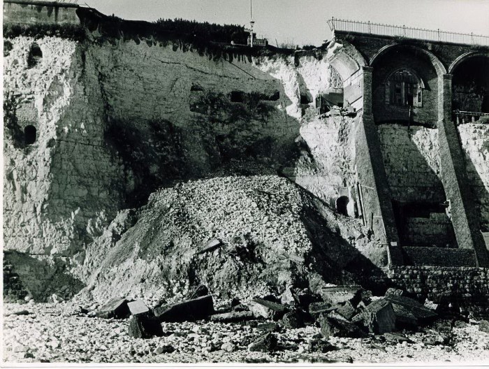
I managed to get a bit more information on the caves attached to Pugin’s house that collapsed spectacularly in the 1940s, I was discussing the cliff repair works behind the Pleasurama site with Paul Wells who came into the shop yesterday. Paul is very much involved with the Kent Underground Research Group. One of our concerns about the site is that there is what appears to be a very large cave under Wellington Crescent shown on some old maps.

One of these maps was drawn by Brimmel the borough surveyor who was not a person to mistaken about something like the existence of a cave, it has been my contention for some time that as the various surveys of this area show the chalk to be in poor condition this cave should be investigated and if necessary made safe.

Anyway Paul said that he had managed to obtain the Bimmel’s drawings for the repairs to the collapse of Pugin’s caves, so I asked him to photograph them and publish them on web so we can have a look at them.

Paul Wells is also the historian who produces the Dover Past website http://www.doverpast.co.uk/ and has an interest in underground caves as you can see from http://www.flickr.com/people/doverpast/

Click on the links below to look at the pictures of the various things I have mentioned in this post.

Radar ground survey of Wellington Crescent

Report on the state of the cliff façade of Wellington Crescent

Pictures of the collapse of Pugin’s caves

Bimmel’s drawings for the repairs

Dover Past website

Paul Wells’s other pictures

Kent Underground Research Group

Sunday, 20 January 2008

Fallen arches


I am becoming increasingly concerned about the safety of our cliffs, having discovered that the cliff behind the Pleasurama site was considered to be dangerous, looking around we have several cliff supports that look to be much more dangerous. The one photographed above has got into this state because of a planning dispute between the council and the site owner, as far as I can ascertain.

Ironically TDC appear to have refused planning consent because the development could be viewed from the conservation area above, I say ironically because they seem to be behind the Pleasurama application further along.

If you click here you can see just what a mess this site has become and if you click here you can see what happens when the cliff collapses.

The site itself is just one of many where the safety fencing is broken meaning that children can get into this dangerous area.