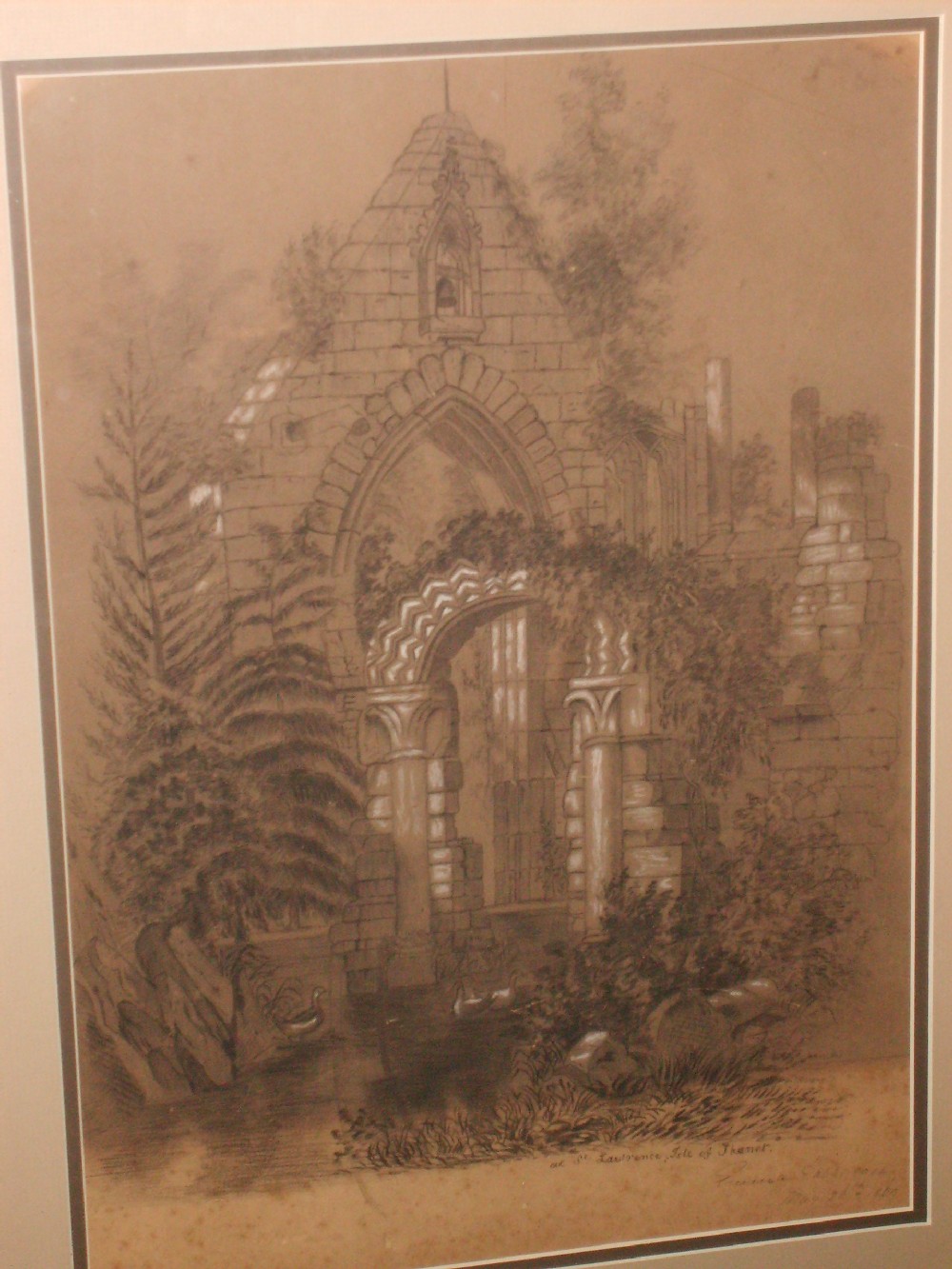
I have just received this picture from Alan, he says.
“This picture is most odd. It's a photo of a very large picture drawn by Emma Harrison - the best that I can come up with from the signature. It was drawn in 1869 and is simply entitled, 'At St Lawrence's, Isle of Thanet'. It seems to show a redundant church or chapel, but of course St Laurence was not in a derelict state during that period, and architecturally it is totally wrong to be that building. The question is, where on earth was it? It certainly isn't the remains of the church at Woodchurch [the foundations still shown on maps of the period], neither is it the chapel at Manston Court. As the thing is on our wall at home, I would naturally love to establish where it was. I suppose it could always have been drawn from the imagination of the artist, or could have been copied from an older engraving - so perhaps had disappeared by 1869?? I can't find a good candidate for a Emma Harrison living locally on the 1861 or 1871 census, so guess that she may have been visiting Thanet when she undertook this.
Would any of your bloggers know??”
Ed. This is Holy Trinity Chapel it was built in the 1300s and demolished in 1892
Edward Wedlake Brayley mentions it in his book Delineations Historical and Topographical of the Isle of Thanet and the Cinque Ports, there is also an engraving of the chapel in the same book by William Deeble. I publish a cheap reprint of the book
click here for sample pages.
The chapel was a short distance east of St Lawrence Church, it was endowed with some lands for maintenance of a priest but these endowments were converted to a lay fee after the reformation and the chapel became a cottagers dwelling. By the beginning of the 1800s it was roofless and derelict it was demolished in 1892.

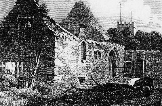
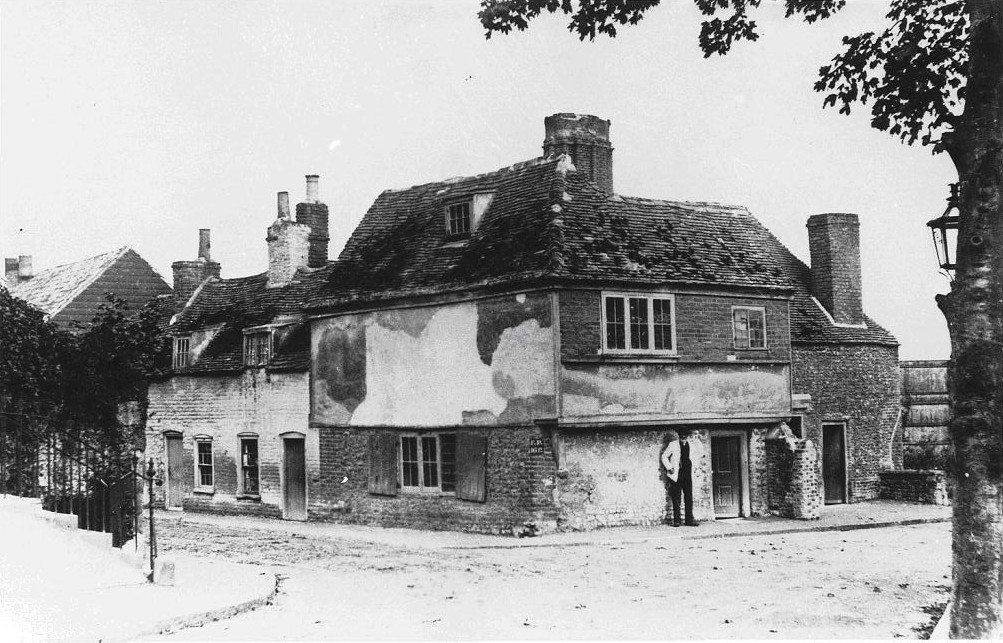 The pictures (from two of my local history publications) click here to enlarge are the ones I promised to publish the other day, showing Holy Trinity Chapel and its priests residence, the Chantry House (on the junction of Ellington Place, left and Grange Rd. right) more detail about the chapel in my previous posting.