
As you can see from the picture the shape is an oblong with
curved ends and the brickwork extends down about 2 metres.

I guess it must date from somewhere between 1800 and 1900
and was in the grounds of Townley House and Townley Castle when it was built,
click here for a potted history of both http://www.michaelsbookshop.com/blogpicts2/townley.htm

The picture above is Townley castle built around 1800 it was on the Chatham House School site.
I am pretty sure that this was a water well, but the shape
is unusual, possibly that shape for a chain pump.
The water table there would be about 70 feet down so a suction pump wouldn't work.
 This 1872 map shows the location of Townley Castle
 and this map the sheet to the right or east of the previous one the red oval is roughly where the hole is.
Brick lining the top metre or so of a well is fairly normal practice.

Looking at this map which I need to check the date of.
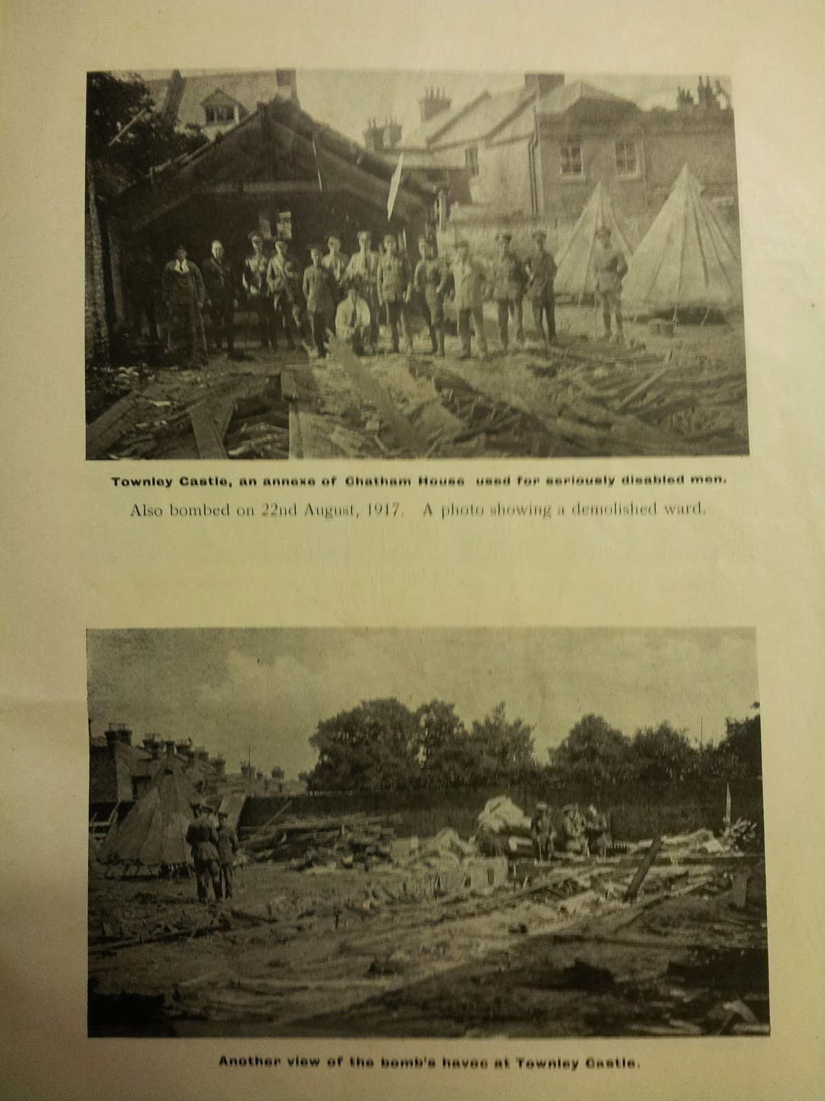
I think Townley Castle may have been finished off WW1 bombing although the information from the time is a bit vague.

Brick lining the top metre or so of a well is fairly normal practice.
I guess the nearest building was St George’s School so it
could have been related to the water supply for that. I think Chatham House and
St George’s School shared the playing fields
Looking at this map which I need to check the date of.
I think Townley Castle may have been finished off WW1 bombing although the information from the time is a bit vague.


I will add to this post as thoughts occur to me.