The council planning committee turned this one down recently, it has been to the planning inspector for appeal, here is the link to their decision http://www.michaelsbookshop.com/laptop212/id4.htm which was to allow the development to go ahead.
I didn’t oppose this development as I guess almost anything would be better than what is there now, I would have preferred something in the style of the original Granville Marina but planning in this country doesn’t work that way.
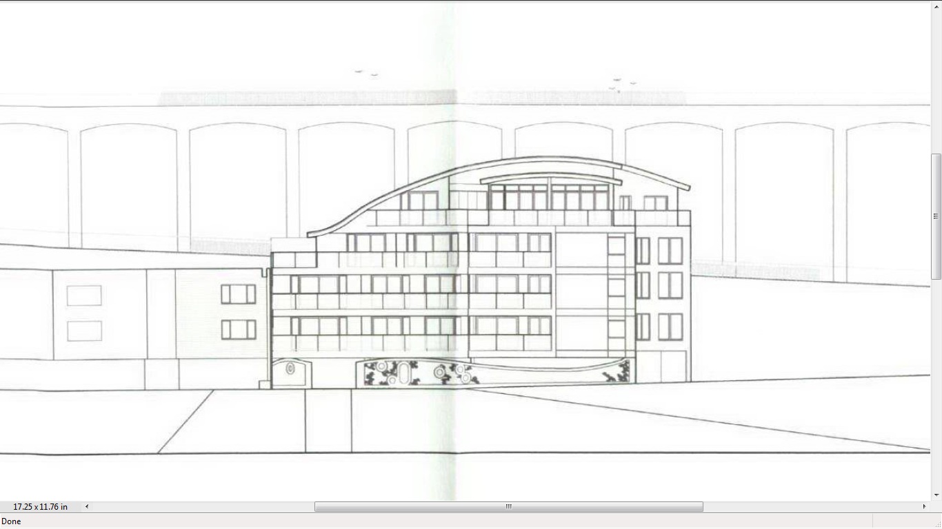
 I do have some concerns about developing this site, one relates to the drain in the arch behind it.
 The other relates to the condition of the arched inclined viaduct behind it and access to this structure for maintenance.
What appears to happen in practice is that when we have heavy rain the valve gets stuck and the force of sewage and water lifts the manhole cover, under one of the arches, in the picture. Harbour Parade also floods although this may be purely coincidental.
I didn’t oppose this development as I guess almost anything would be better than what is there now, I would have preferred something in the style of the original Granville Marina but planning in this country doesn’t work that way.


My understanding of the drain, which may be inaccurate, is that this is a mixed surface water and sewage pipe that comes down the cliff here and is connected to an emergency outfall pipe into the sea, this has a pressure relief valve on the seaward end that has a tendency to get stuck.
What is supposed to happen here is that in normal circumstances, the sewage and surface water is piped down the cliff, goes along the frontage of Granville Marina, through the Pleasurama site and along Harbour Parade. During heavy rainfall the system can’t cope with the flow of water and the pressure relief valve opens discharging the excess into the sea.
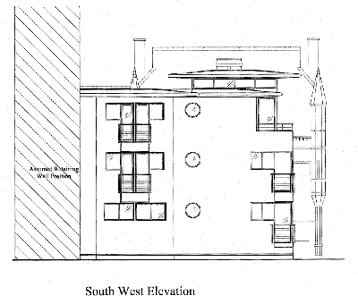
The other problem is the structural integrity of the arched viaduct, this one is a bit complicated, but I will do my best to explain it, there may be some errors in this explanation as the local councils haven’t been very forthcoming in sharing information.

The basic structure is in the form of an inclined brick arched viaduct against the chalk cliff, most of the original frontage was a timber framed façade, covering what is effectively a line of short tunnels in the front of the cliff.
The road on top of the viaduct is to be the main vehicle access to The Royal Sands development including the public service vehicle (bus) access.
My understanding is that after the big cliff collapse at the top of the incline in the 1960s, the then borough surveyor decided it wasn’t safe to allow traffic to go down the hill, because of the stresses cased by a line of vehicles breaking hard down the hill.
So this was turned into a one-way road, up hill only.
Normally an arched brick structure like this would be constructed with engineering bricks of uniform hardness and it would be easy to calculate the loads and stresses it could withstand.
The inclined arches on the waterfront of Ramsgate Harbour are a good example of this, these arches also have the advantage of concrete infill between the arches and under the road above.
The Granville Marina arches are made of Victorian house bricks with varying hardness’s and has a loose chalk infill.
There is no weight limit imposed on this structure at the moment, so it is perfectly legal to drive 38 tonne lorries up and down it.
Anyway I did some calculations and came to the conclusion that the point at which the structure would be likely to fail would be around ten tonnes per axel and pointed this out to KCCs engineer.
He responded to me that the structure was safe with no weigh limit on it, but wouldn’t tell me what he calculated the maximum axel weight to be, the safety margin he had used, or what program he had used to calculate it.
My main concern however is about the stresses cased by a train of vehicles travelling down the hill and having to brake hard in an emergency. The whole structure vibrates when one lorry does this.
You can find the various planning applications for Granville Marina by doing an alphabetical street search on the same website, some are listed under Marina Esplanade and some under Granville Marina.
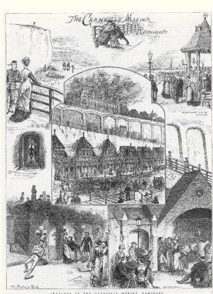
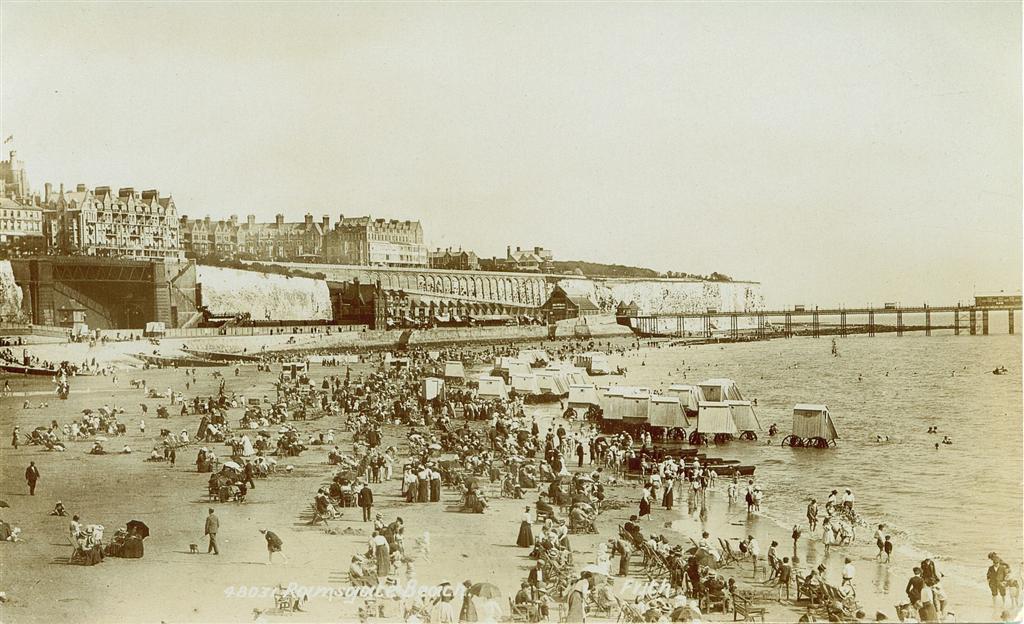
 Anyway this is what this area used to look like. In case you are wondering the picture was taken from Ramsgate pier.
Now we come to the planning references and the planning history of Granville Marina, the planning reference for this application is Planning ref F/TH/11/0244
Because of the peculiarities of the council’s planning website I can’t link to the application, you have to go to the planning website http://www.ukplanning.com/thanet and paste the application into the search box.