
 If memory serves me right this tower was supposed to mark the highest point on the Isle of Thanet, the fact that it wasn’t actually on the highest point in Thanet only goes to show.
I thought it was one of the most attractive of the old prints that I bought today.
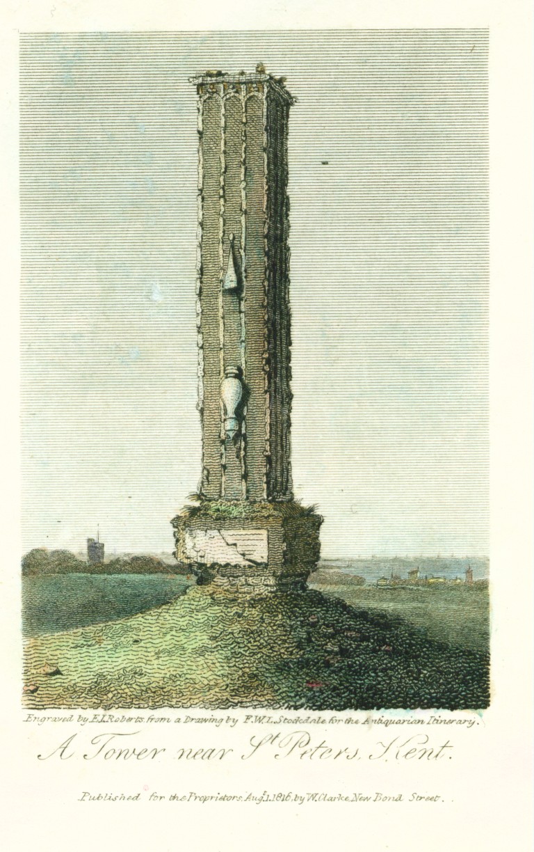
Whitfield Tower was built as a folly, amongst a lot of other follies, by Henry Fox (Lord Holland of Kingsgate Castle fame)in the 1760s.
ReplyDeleteIt was destroyed in recent years - I assume by the 1950s storms.
There was a curious cave found nearby too that is now filled it...
'The Monument' was a seamark , for ships to take bearings from, erected by Trinity House , with permission of Quex Estate who then owned the land. This may have replaced an earlier tower shown in the print. I have a print of the later tower , the 'bobble' off the top , and the two plaques off the base. It toppled over in a storm in the 1970's, and was cleared away by the Steeds who farmed the farm at that time. Clearly Foreness & White Ness points and the North Foreland have always been an an important land falls for shipping entering the straights of Dover , and embarcation points for shipping heading north to the East Coast, the Low Countries or up the Thames. There are lots of sandbanks such as the Margate Hook on which to come to grief if you don't have an accurately plotted starting point. The trees along Northdown Hill and Reading Street were only planted by my grandfather in the 1920's and so the monument on the 'Northdown' would have been clearly visable for many miles out to sea in most directions. Will Friend, East Northdown Farm.
ReplyDeleteI lived at the top of Northdown Hill and remember the Whitfield Tower toppling over in 1978. For weeks before walking from Northdown Park I had noticed it was leaning and realised it would go sooner rather than later. I was still at secondary school and wandered over the field the evening after it fell to pick up some bits of brick, flint etc and mess around with other kids. We were chased off by I presume the farmer. I always understood the lower half was built as a folly and it was added to by Trinity House as a land mark for shipping. The lower base I believe at one time had railings around...though I don't recall so in my lifetime (43 years). I have never heard about a 'curious cave' nearby. Anyone any information? What happened to the plaques off the base. I did once read them but cannot recall now what they said.
ReplyDeletelook on the thanet hidden history site on face book next sunday and all will be revealed ;)
Deleteanyone one know the exact location of where it was standing ?
ReplyDeleteYes I have an old map of the land at Whitfield Avenue just off of Northdown Hill. The house was built in the 1920's but the land around it was left in a Will and then leased out. Anyway on the map the tower is marked somewhere along the bit of farm land some way past the speed camera.
ReplyDelete