
 Click in the map to enlarge it
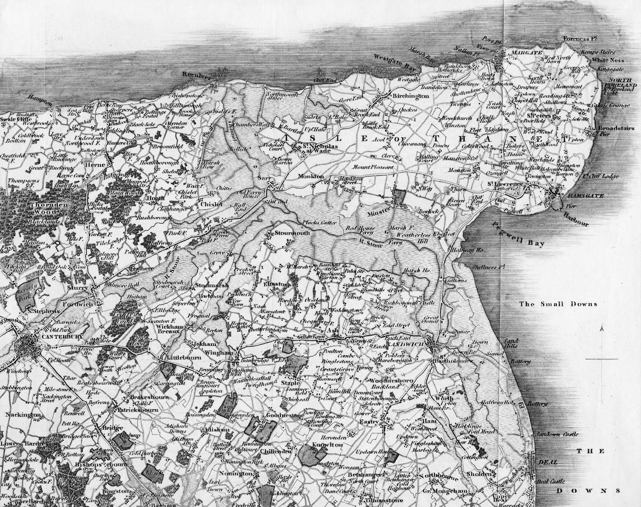
Back in either the 14 or 1500s I will look it up exactly the monks and other farmers reclaimed the land between Chislet and St Nicolas with the winds and therefore the stormy seas in this area coming predominately from the North and West this quite quickly lead to the land shaded grey on the map being reclaimed.
Now I have just read in the Isle of Thanet Gazette that in these times of rising sea levels and increased storm activity Thanet District Council has agreed to remove the sea defences between Minnis Bay and Reculver Towers.
As the designers of the first attempt at the Turner Centre learnt to their cost, you don’t mess with the sea on the North Thanet coast, the great sigh of relief after the 1953 surge storm was that this wall held.
Only 307 people lost their lives in the UK in this storm, in the Netherlands where the sea defences were breached 1,800 people drowned.
I beggars belief these people admit that the Thanet Way will have to go onto a bridge and so will the North coast railway line.
Click here to read the article
The article implies that removal of the sea defences will protect other areas,do you think the area it really means is the Ramsgate Sands development.
ReplyDeleteAs you and i know the sea is a harsh mistress and never sticks to the rules,it is sad to think of the thouands of animals,insects and birds that will have to die because of an ill concieved and indeed life threatening development
of our sea defences.
Sea walls should be built higher to protect the Island and nothing else should even be entertained.
The areas that are being protected with this scheme, are those such as London, Essex, and Pegwell/Deal.
ReplyDeleteI would go further and suggest that a look is taken at the trial places on the east coast, where it seems to be working.
The floods of '53 were not because of no sea defences, but a result of inadequate defences being breached.
To build higher and higher defences means that when they are eventually breached, the results can be catastrophic
Ken perhaps you ought to look at the environment agency flood map click here to do so. How many billion pounds to put the Thanet Way and the railway on bridges that would resist sea storms? How many billion pounds worth of land and buildings? You are a Thanet Councillor telling me that it is quite OK if a quarter of Thanet is washed away into the sea.
ReplyDeleteI get the feeling that there is tremendous inconsistency in TDCs attitude to flood and storm protection, looking at Pleasurama the Turner Contemporary and now this.
The relatively small amount of sea defence involved is what has protected this huge area of East Kent for the past 400 years, with or without rising sea levels, what you are saying is that the sea appears to be rising so stop repairing the sea defences in case it is.
Michael,
ReplyDeleteNo I'm not saying, or even expecting that 1/4 of this place will be washed away, what I am doing is agreeing with the environment agency that in some areas managed retreat is the best, and most cost effective way.
The land we are really talking about is the marshes between Minnis Bay and Reculver. These are pretty poor agricultural land, (and mostly in 'Set Aside'). I understand the plan is to build a more sustainable defence towards the Thanet Way. This road is vulnerable for about 2km, the rest being on high ground. If the Railway was built as part of the defences costs would be lower.
The billions it would cost would have to be funded by central gov't, via the Environment agency.
Seriously, we will gain more of a voice by working with them, as it's 'their' money
Maybe it;s better if we let the land flood, we will once again be a true Isle, and we can send TDC in a boat back to the mainland. Our isle will then definetly be a better place, at least we won't have anymore of those council prison like fences currently being built all over Thanet.
ReplyDeleteKen what we have at the moment is an exposed area north facing low ground that extends all the way to the coast on the southern side of it. It is currently protected by two lines of defence on either side of the marshes, that in a worst case scenario act as a buffer zone by making the sea shallower and therefore the wave action less severe.
ReplyDelete